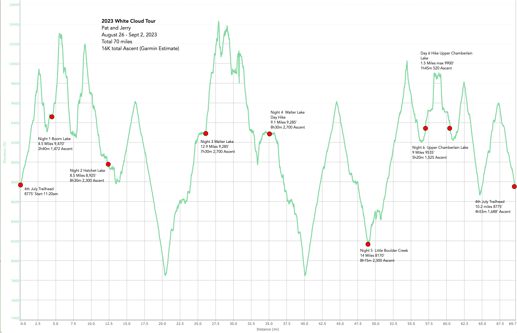
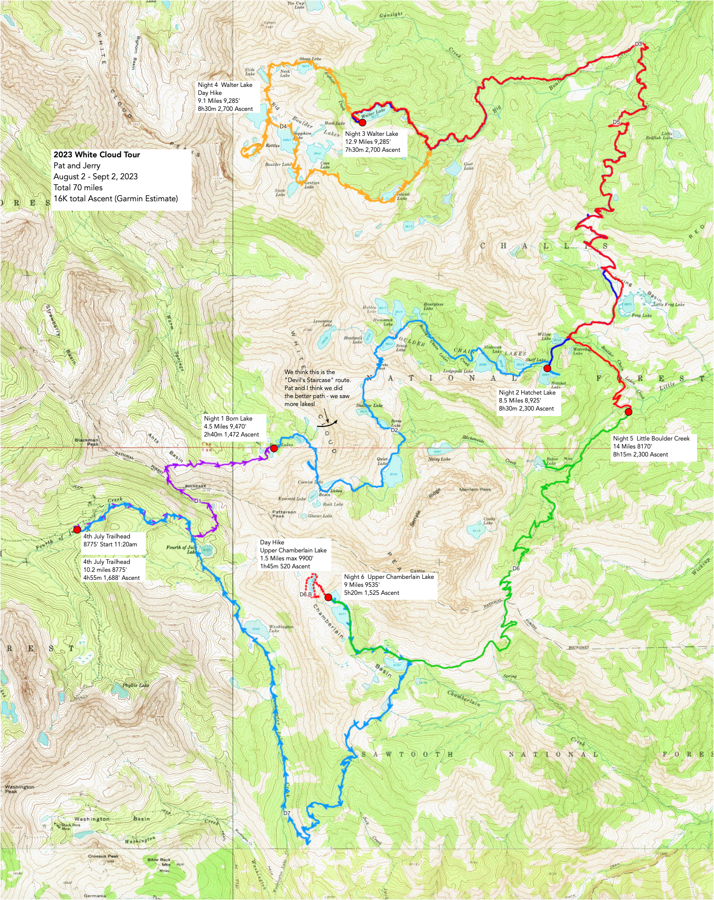
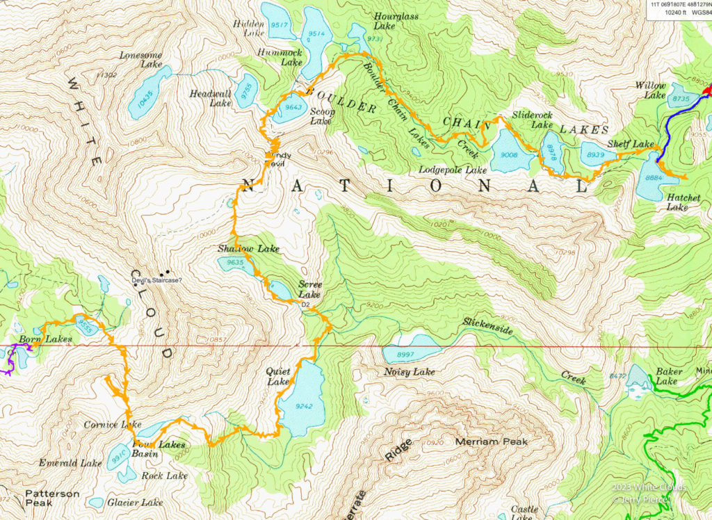
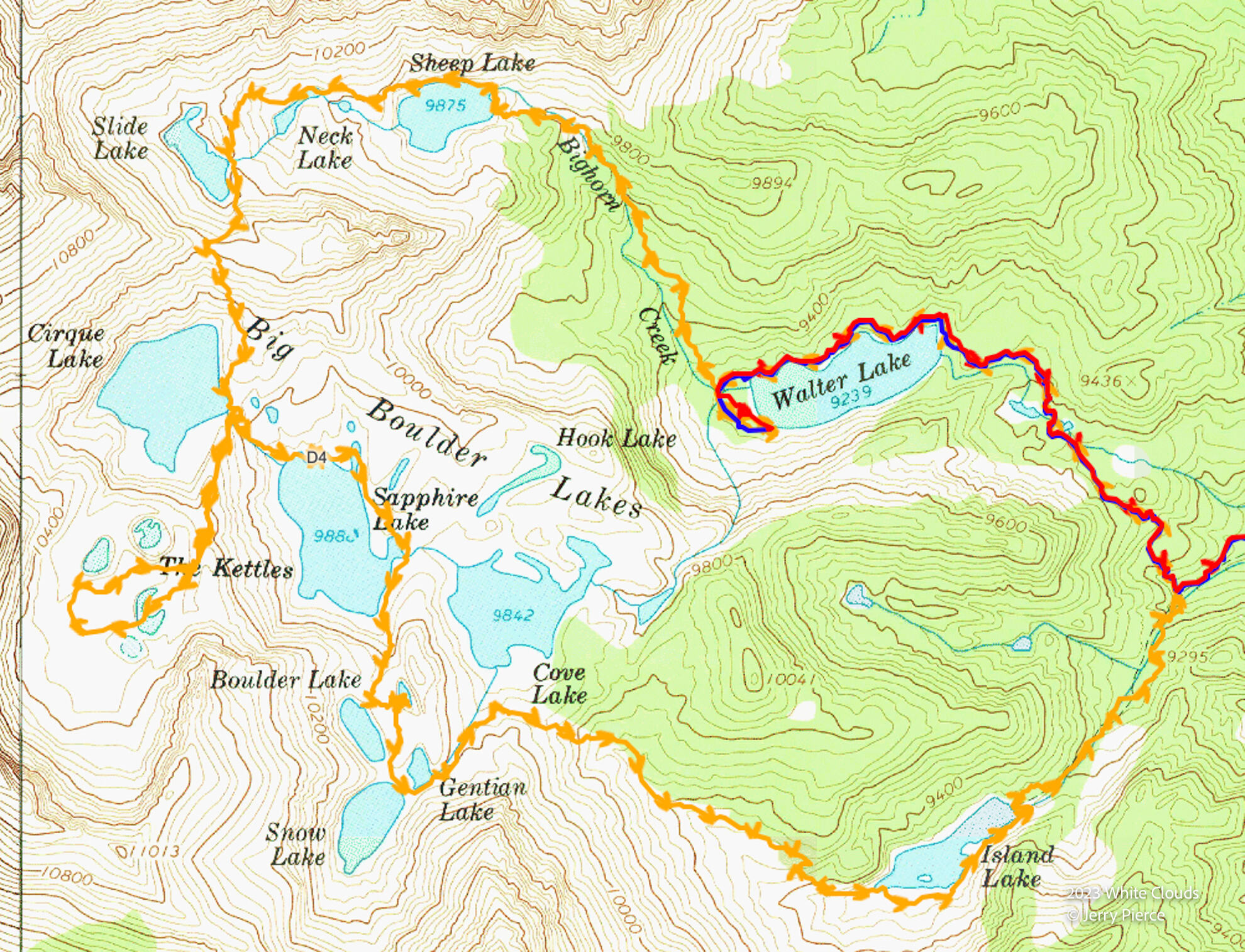
Here is the .gpx of the trek: https://files.jerrypierce.org/gpx/2023-White-Cloud.GPX
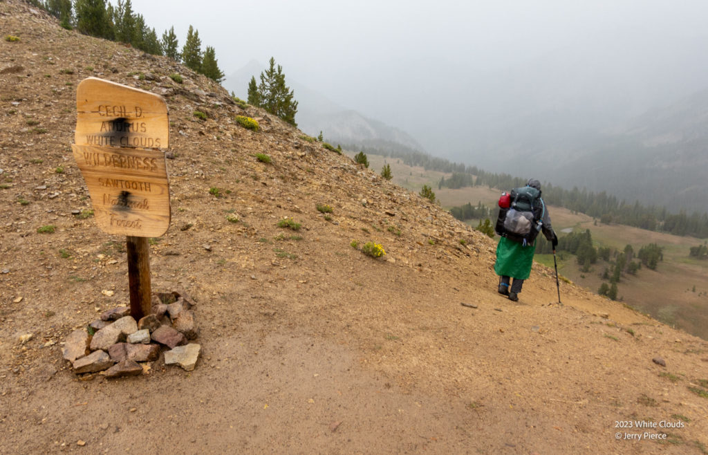
White Clouds Wilderness is the sister of the more famous “Sawtooths” in Idaho, just south of Stanley and about 80 miles northeast of Boise. We had heard that White Clouds was a really pretty place, so off we went on a 7 day / 6 night tour of the Wilderness. Mostly “on-trail” but it ended up having a significant amount of off-trails sections.
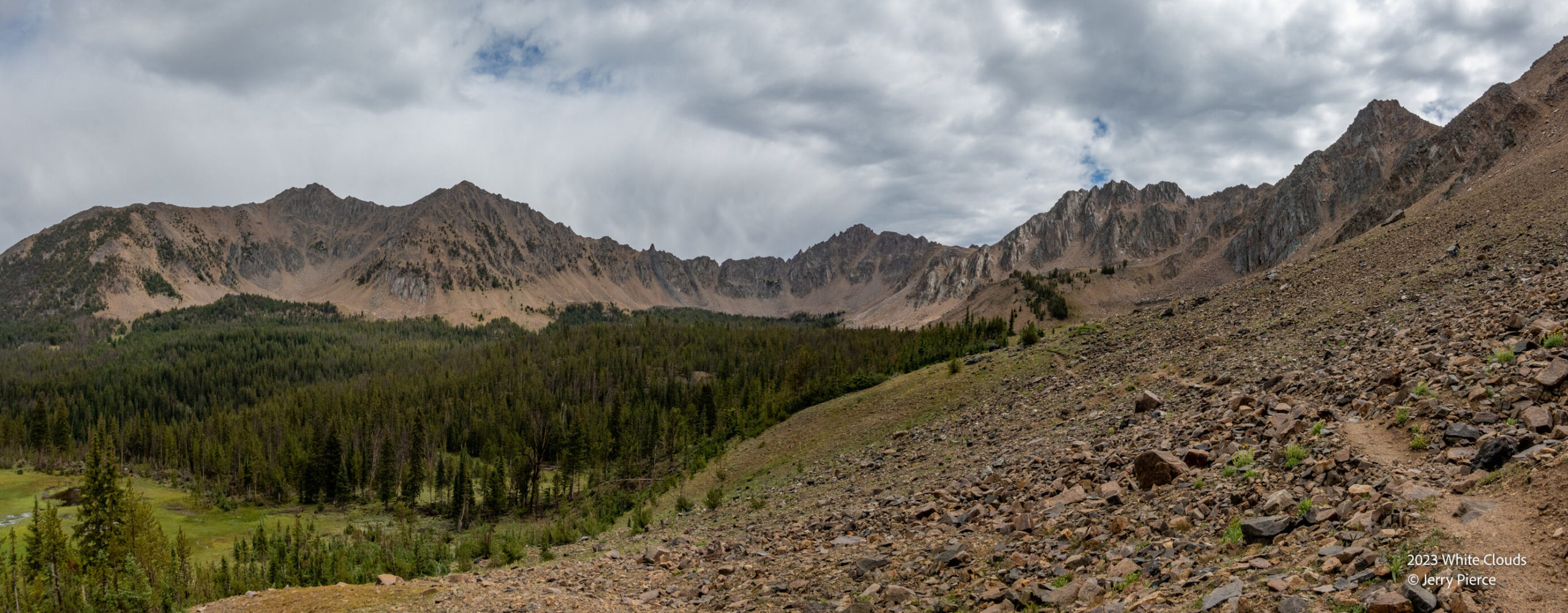
White Clouds exceeded expectations. It’s a fairly constrained area – maybe 20 miles high by 12 miles wide – but the variety of regions is delightful. From above timberline (and above 10K’) to forested to old burns. Lakes and steams for good camping (probably good fishing) and the people we encountered were friendly!
Not sure I would go back again since we did see most of the highlights, but I would highly recommend it to anyone interested in seeing some pretty sights.
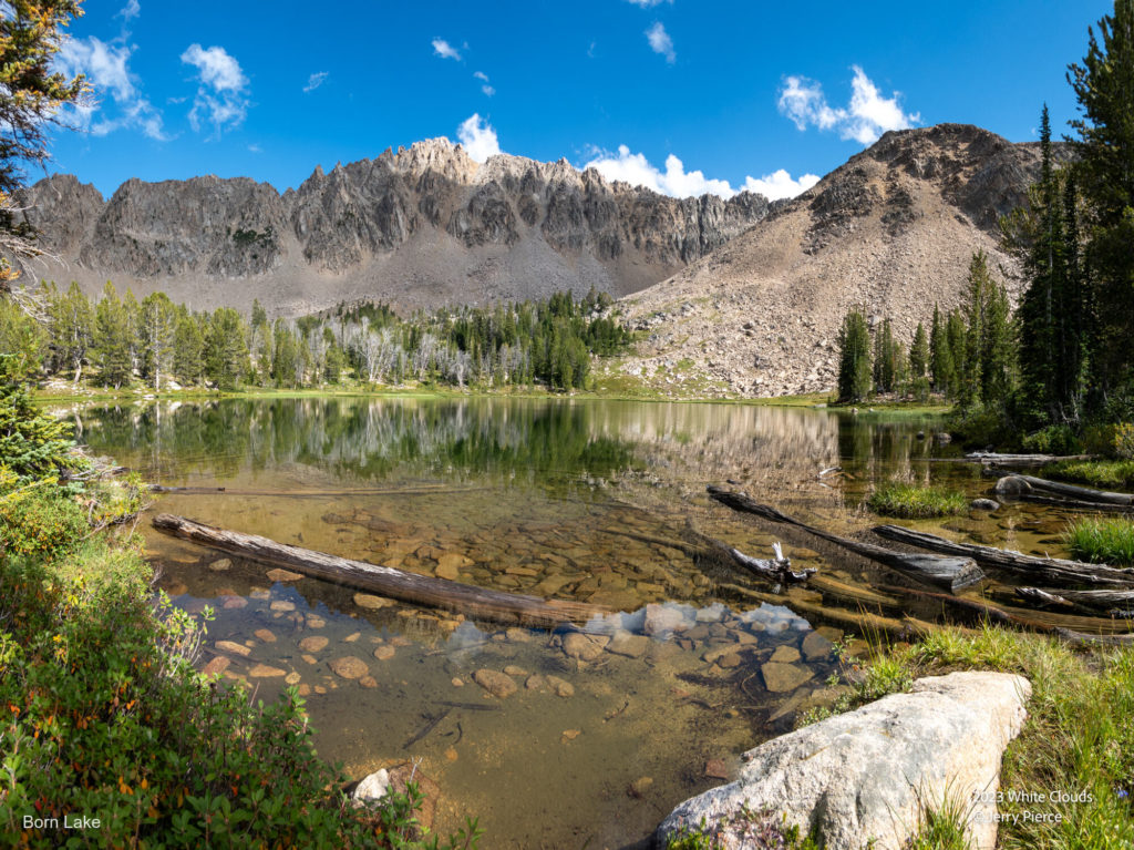
Pat and I both drove in the morning of departure – the Saturday of Labor Day weekend. We had been warned that our trailhead would be crowded and it was. LOTS of day hikers. We headed out of Fourth of July trailhead to our first night at Born Lakes. NO MOSQUITOES! (Always a bonus.)
Pass into Antz Basin and the Born Lakes
It’s about a 5 mile walk into Born lakes and it goes over a ridge to drop down to Antz Basin and the lakes. We had a short thunderstorm with rain and hail as we approached the pass, but nothing too close so we didn’t stop to see the sights as we headed down. We talked with two hikers headed out and we learned of the infamous “Devil’s Staircase” a challenging way of getting out of the Antz Basin, but we didn’t have a clue if we were going to take that route… We also heard of “Windy Devil” pass – THAT was on our route, but it was unclear if that was a good or a bad pass.
We passed another hiker and they told us of a campsite on one of the Born lakes that was stellar, so off we went with a campsite in mind – we got it and what a delight for the first night in the Clouds.
Looking up to the Born Lakes
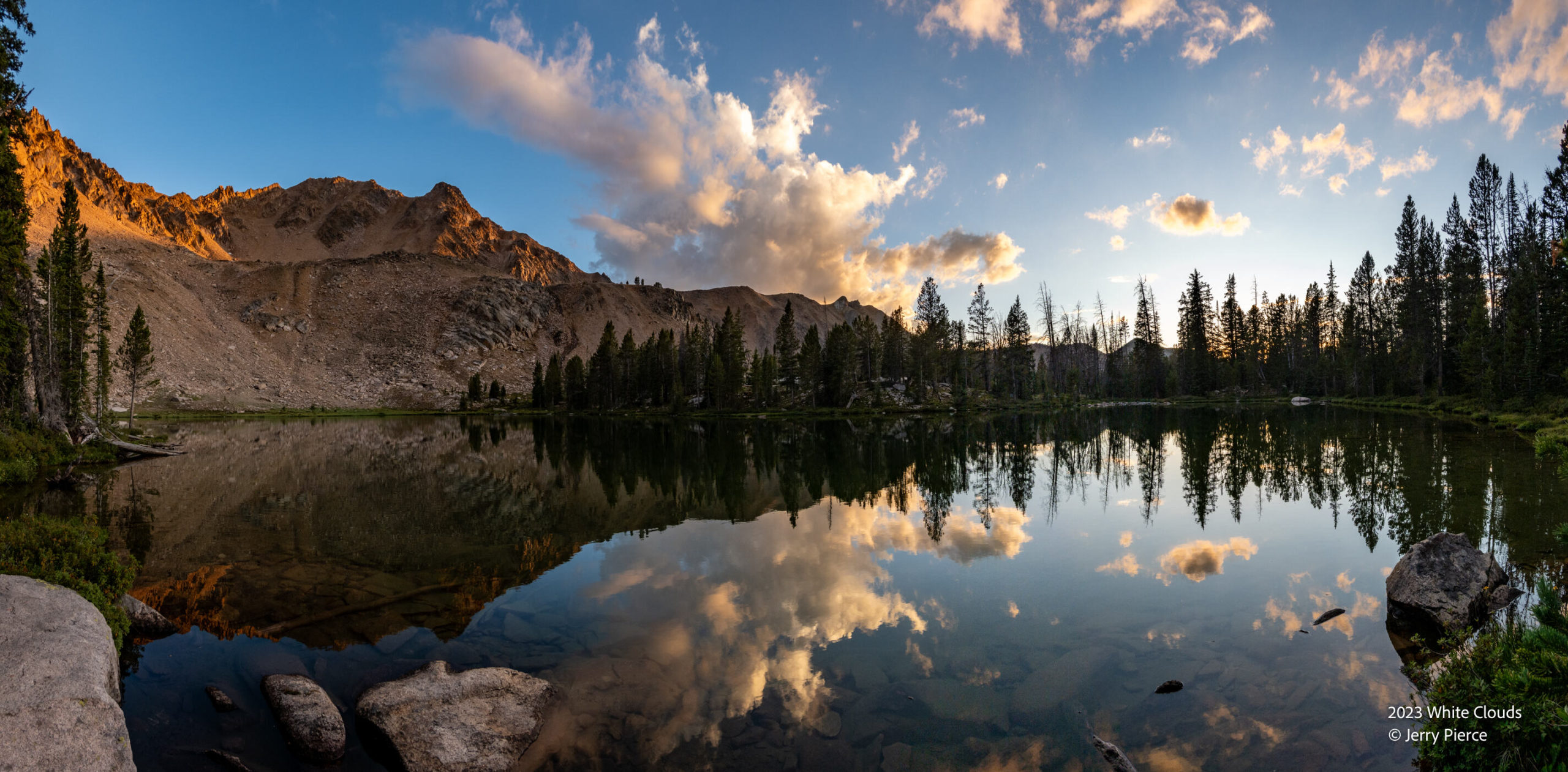
The sky cleared for our afternoon of exploring the Born Lakes
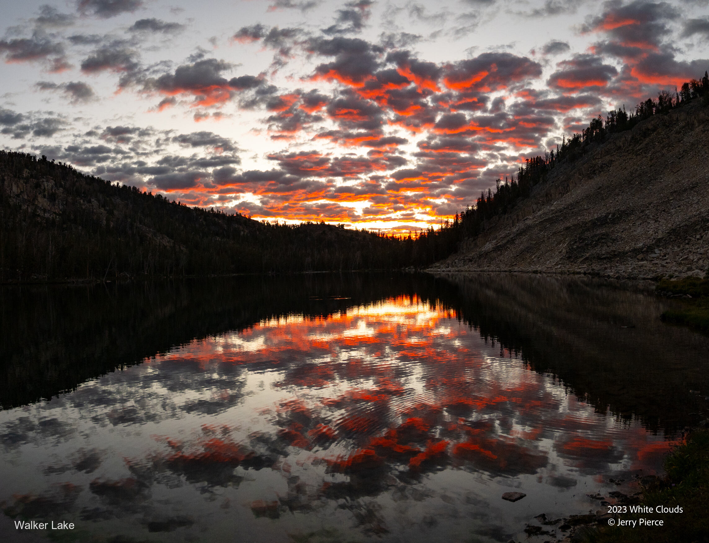
Sunset at Born Lake – We really had a nice campsite!!
We did an exploration of the basin to see our exit route and to see some of the other lakes. We met yet another friendly camper who was also trying to figure out the best way to go off-trail and over to the four lakes basin.
Our exit was to the right of center of this picture. Nice use trail going up.
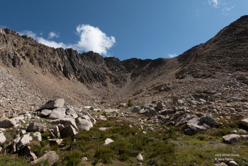
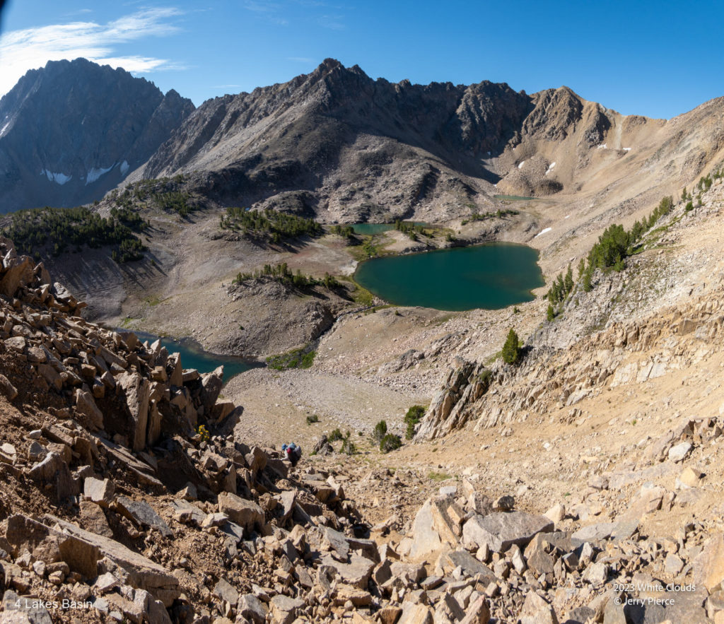
The next morning off we went to the hardest day of our trip. Up and over the Born Lakes pass and down into Four Lakes Basin. The going up was easy (a good use trail), but the going down was very steep and we took the route-less-travelled (meaning the correct route was to the east, but we didn’t see it until we were down). Lots of sliding on our butts and careful placement of feet.
The map showed a use trail down the Four Lakes Basin, but the GPS track was our best way of following the trail. Every-so-often we would spot some sort of use trail, but few and far between.
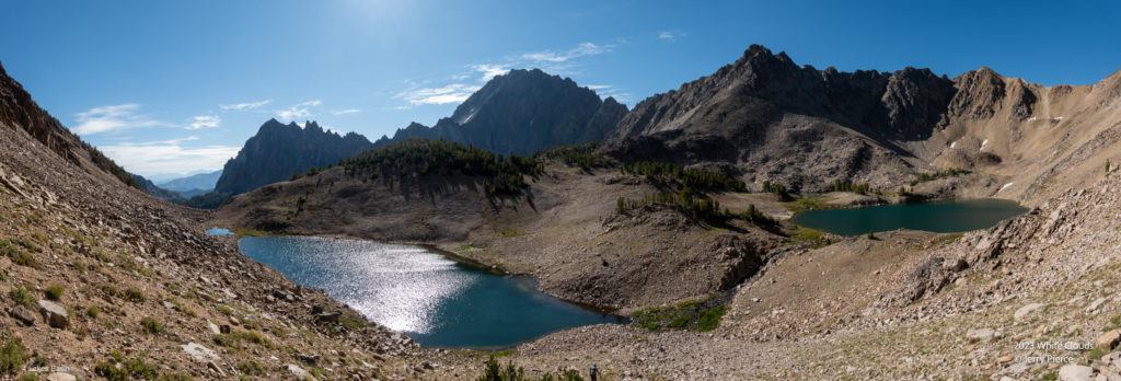
This day gave us the chance to pass 14 big lakes on the way to the second night camping. BIG lakes and very pretty! No sign of weather, just delightful hiking. We did not see another person the whole day. And the wild flowers were out in force!
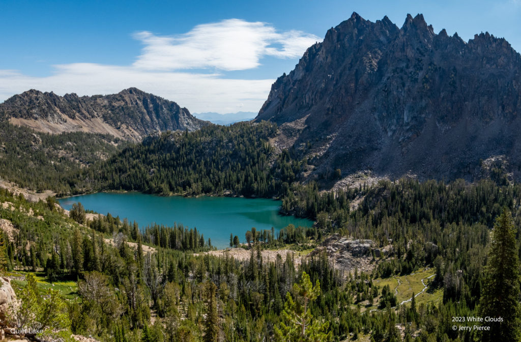
We were headed down the Valley out of Four Lakes to Quiet Lake
And the Four Lakes Basin! (Glacier, Emerald, Rock and Cornice Lakes)
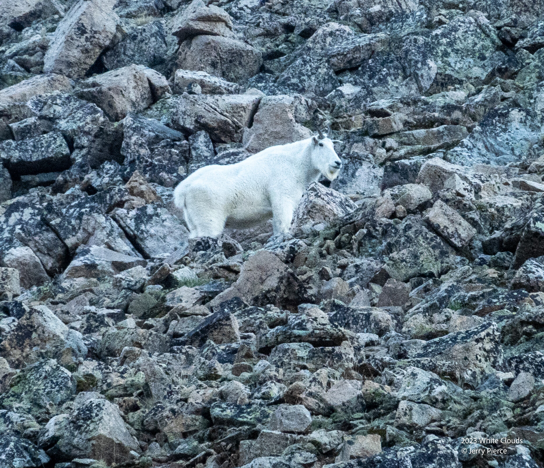
As we left the Born basin we saw this mountain goat on the hill.
On the other side of the pass it was a bit more challenging. We should have gone to the shoot to the left of this rocky down.
Quiet Lake – Lake number 8 for the day (Noisy lake is over that hill)
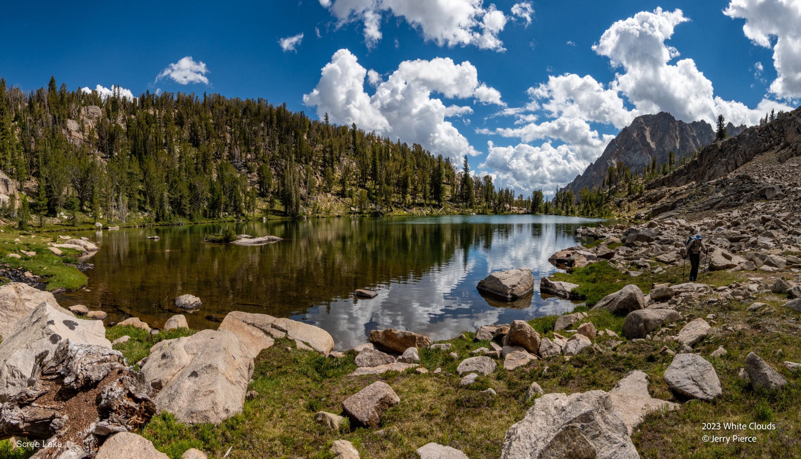
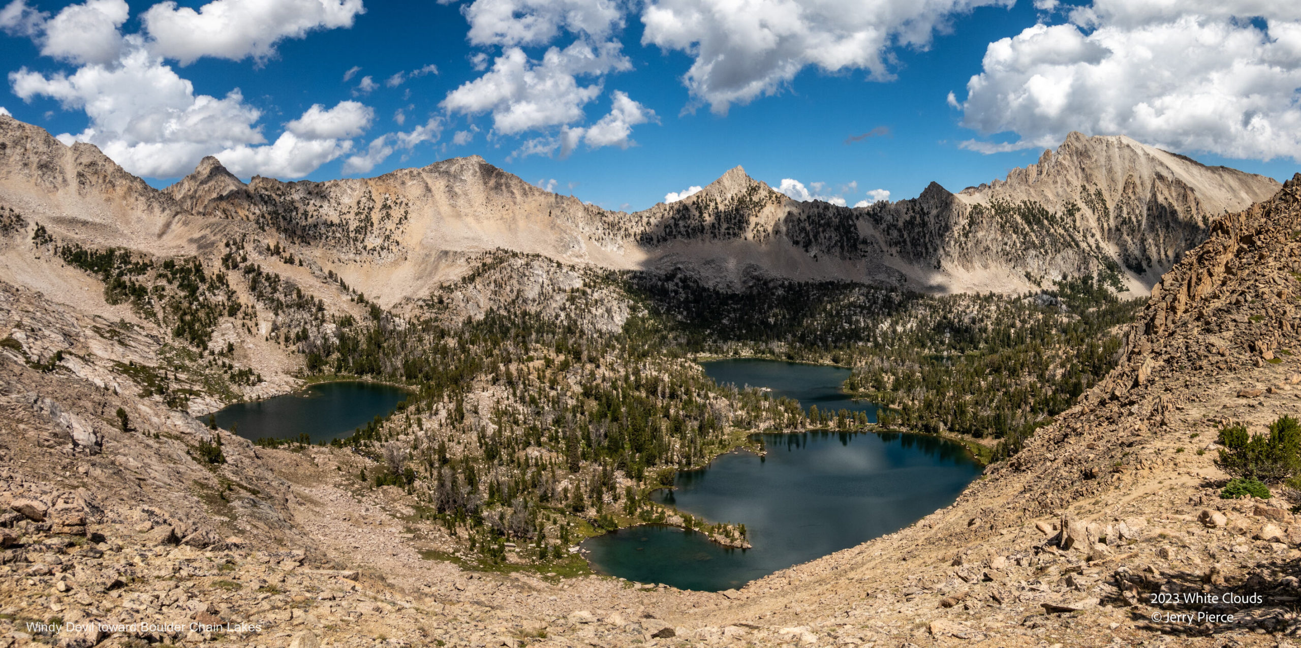
Just past Quiet lake, was Scree Lake – headed to Windy Devil Pass
The view down from Windy Devil pass – a really good trail over very steep terrain
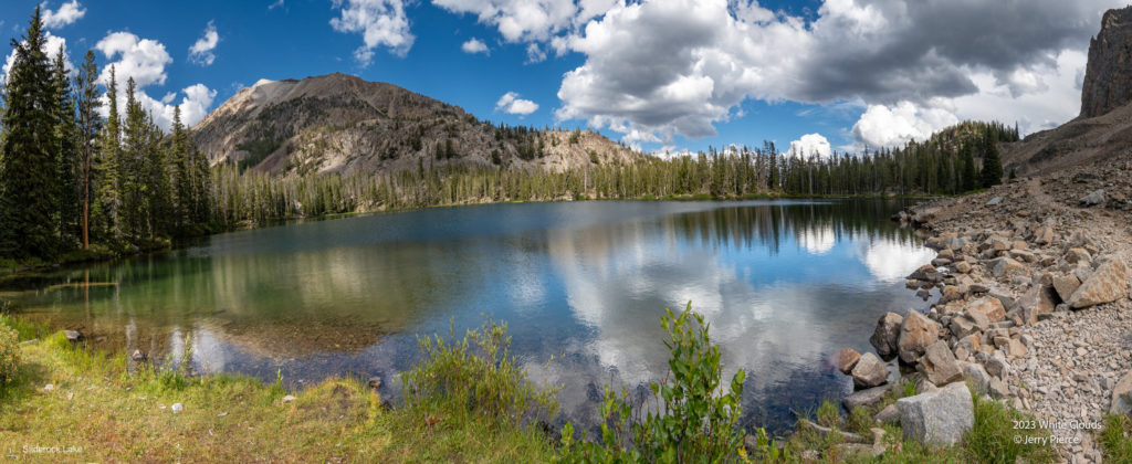
“It’s all downhill from here…” We headed down the Boulder Chain Lakes past Scoop, Hammock, Hourglass, Sliderock, Shelf and finally to Hatchet Lake. Long day – 8.5 miles but a lot of it off trail.
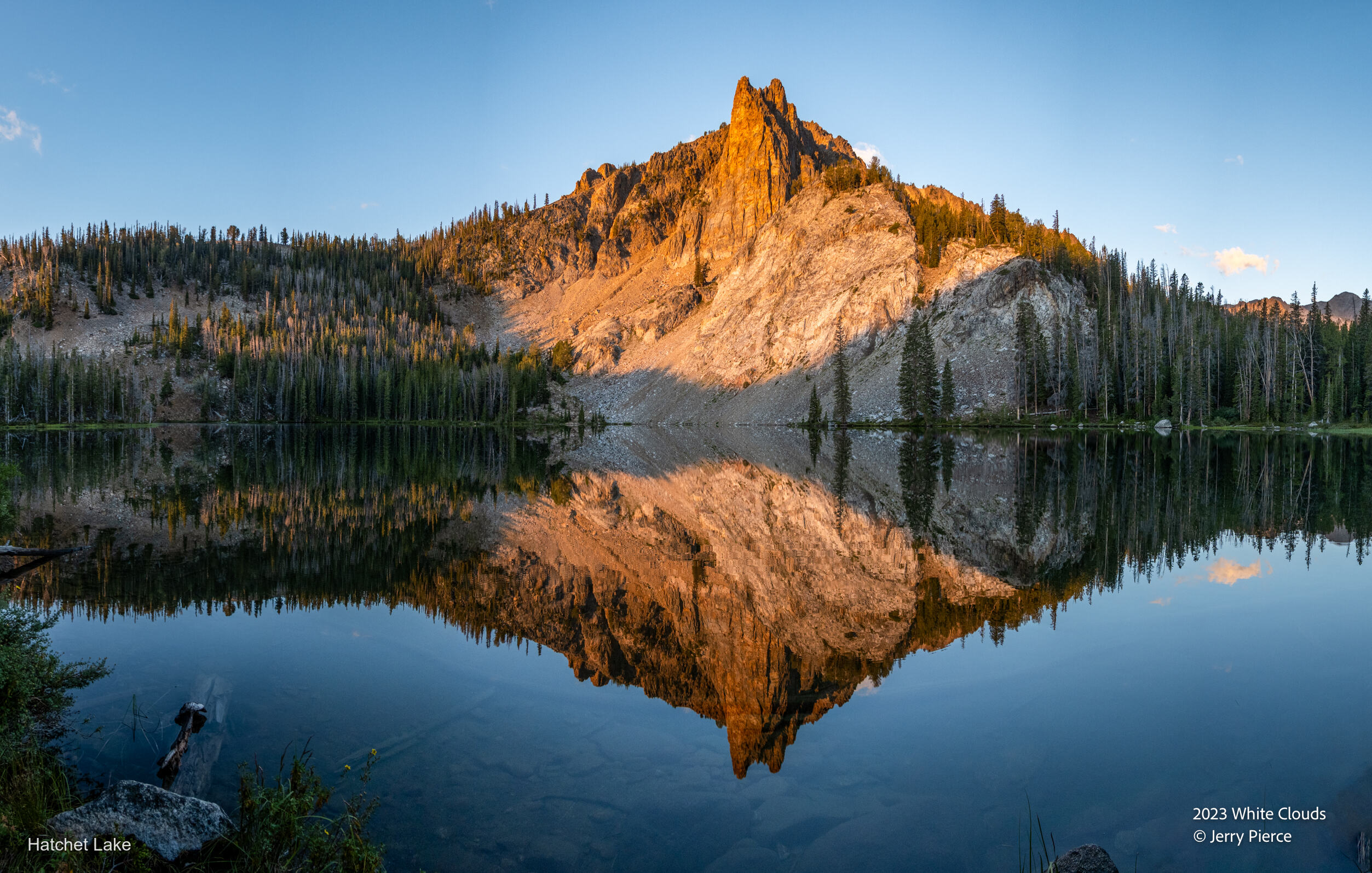
Hatchet lake had a major camping area and it looks like it was very horse friendly. But we were the only ones at the lake. A so-so camp-spot, but not all can be A+!
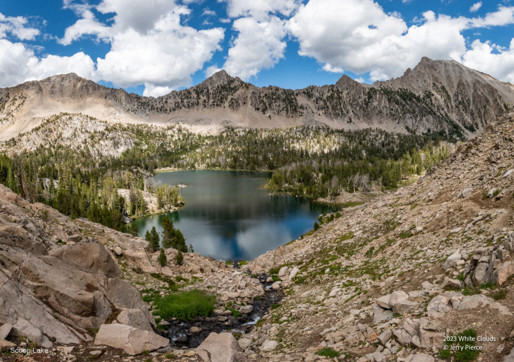
Scoop Lake
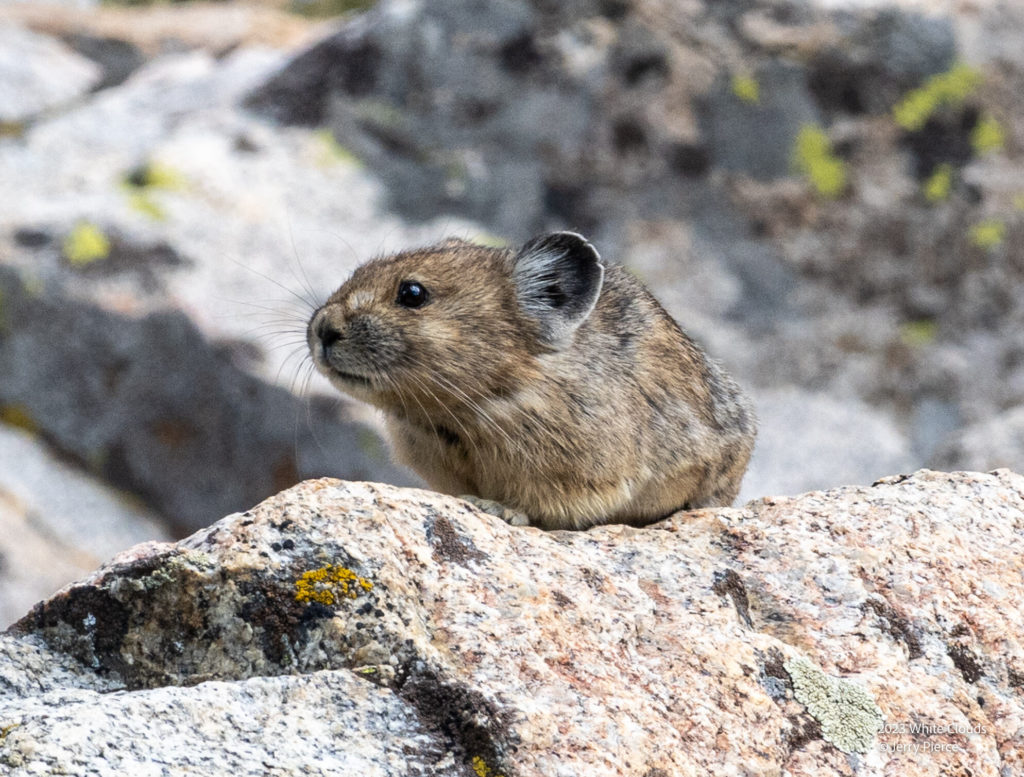
A Pika was not pleased that we were near his food.
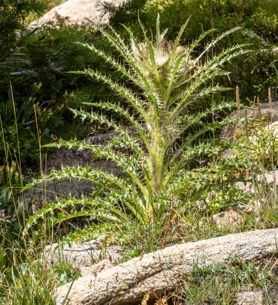
Delightful flowers and plants!
Sliderock Lake
The camp site may not have been spectacular, but the lake provided a really good show for sunrise!
Hatchet Lake Sunrise
Day 3 took us from the Boulder Chain Lakes up to the Big Boulder Lakes. Only a few miles north we needed to walk WAY around to get there.
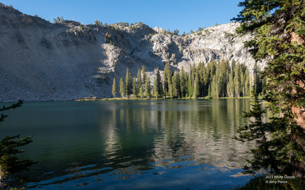
We went past Frog Lake and up the long trek along the Castle Divide Trail (which is open to motorcycles!). A long down then back up to Walker Lake which is in at one end of the Big Boulder Lake loop. Once again we encountered friendly hikers (this time a brother/sister) that gave us the info to get the BEST campsite on the lake.
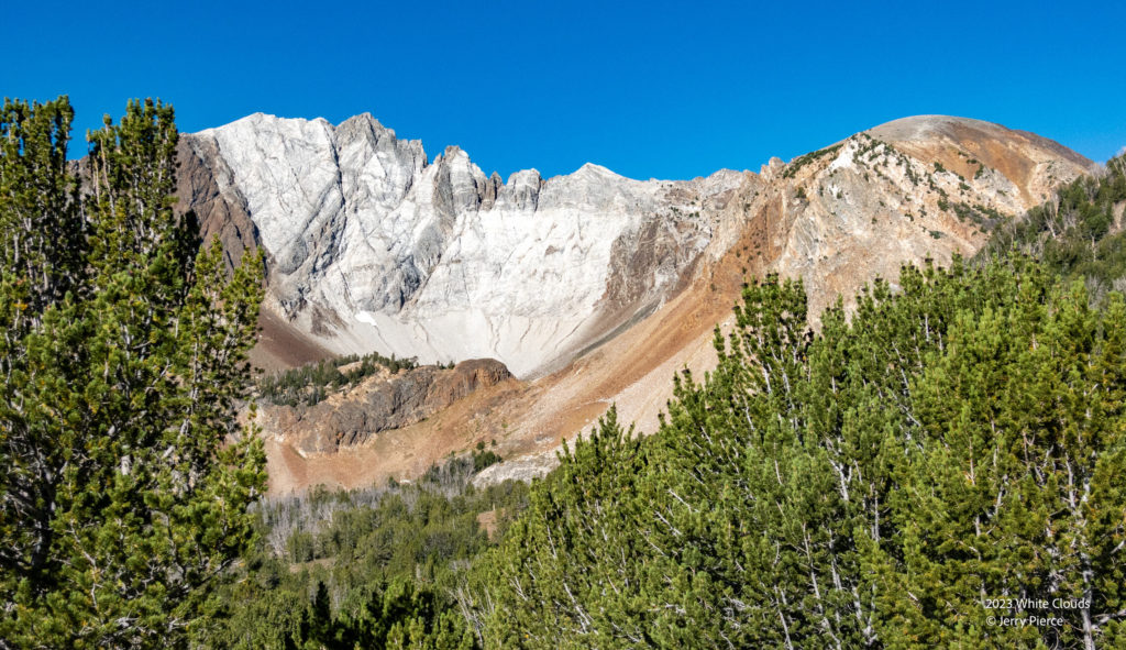
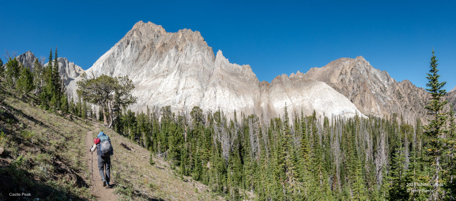
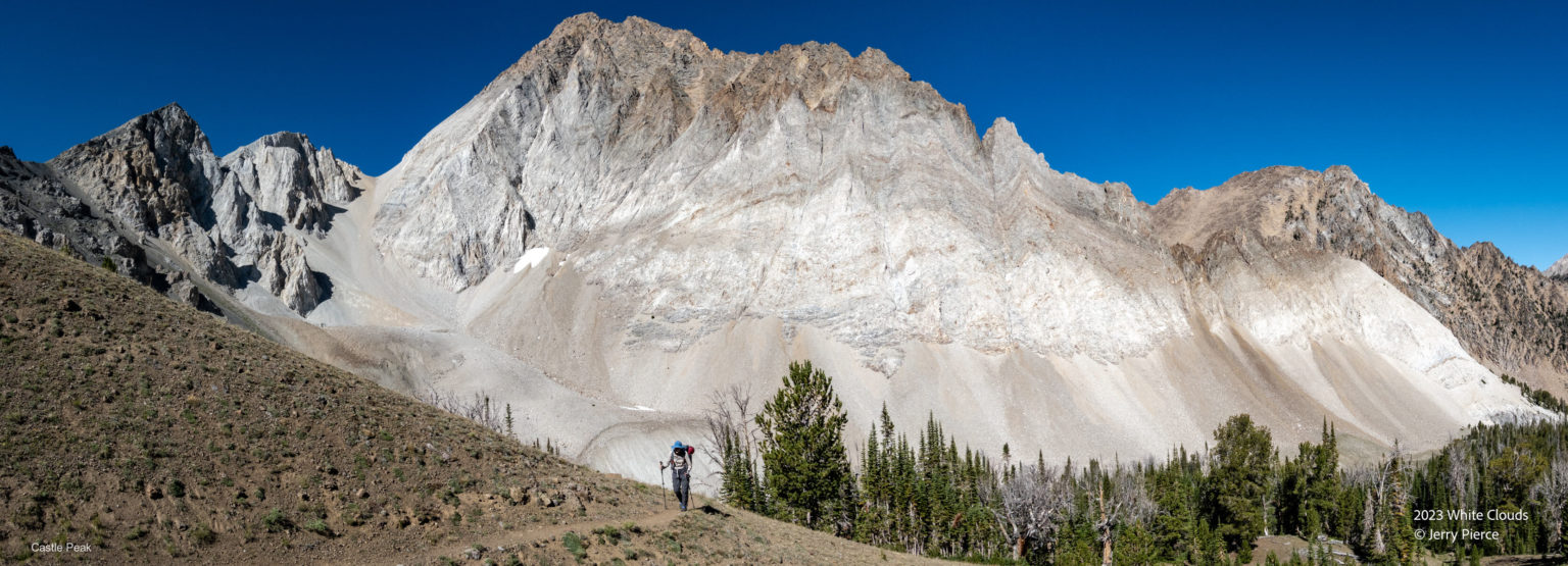
The White Clouds from the Castle Divide Trail
We settled in and planned for the next day as a day hike around the basin.
The approach to Walker Lake
Looking across the lake at our campsite
With a full moon and a long exposure it looks like daytime (except for those silly tracks in the sky) Taken at 11:30pm
The next morning we were treated to a delightful sunrise. Did I mention we had the best site on the lake? 😉
Day 4 was our day hike in the Big Boulder Lake Basin. WOW!
Amazing number of lakes and changing terrains. From glacier lakes to glaciers under small rocks, we saw it all!
It was definitely off-trail, but easy to make the loop (a long loop)
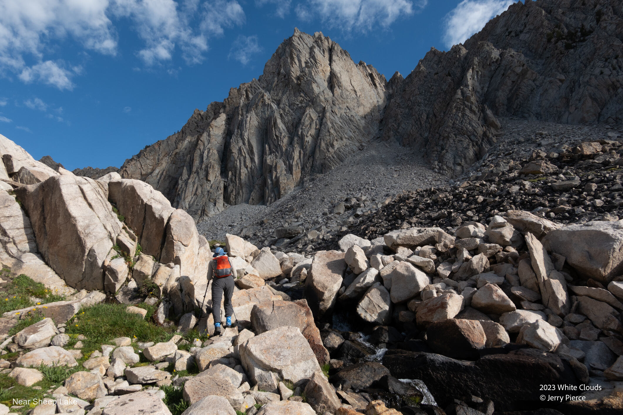
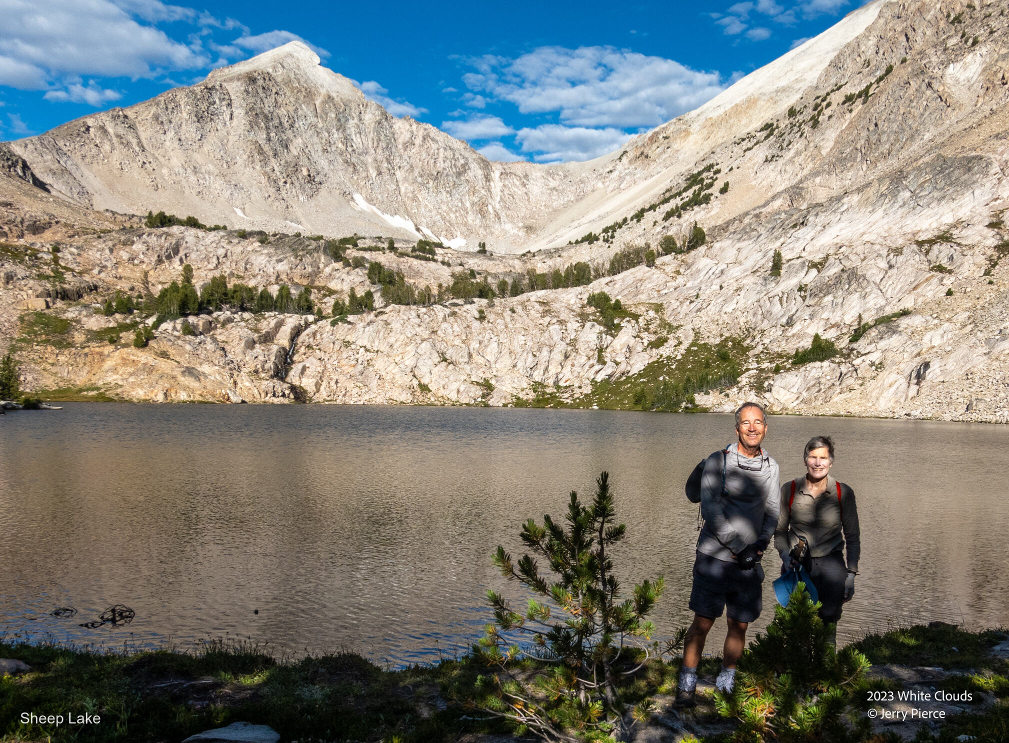
Sheep lake – our first stop on the tour
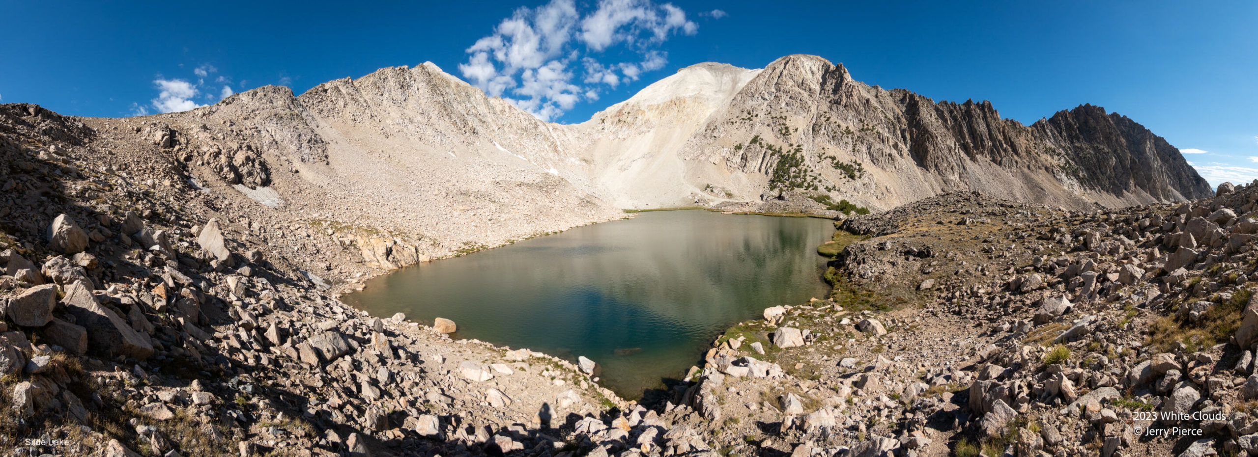
Next was Slide lake – note far fewer trees. The pass was the high point of the entire trip at 10,400′
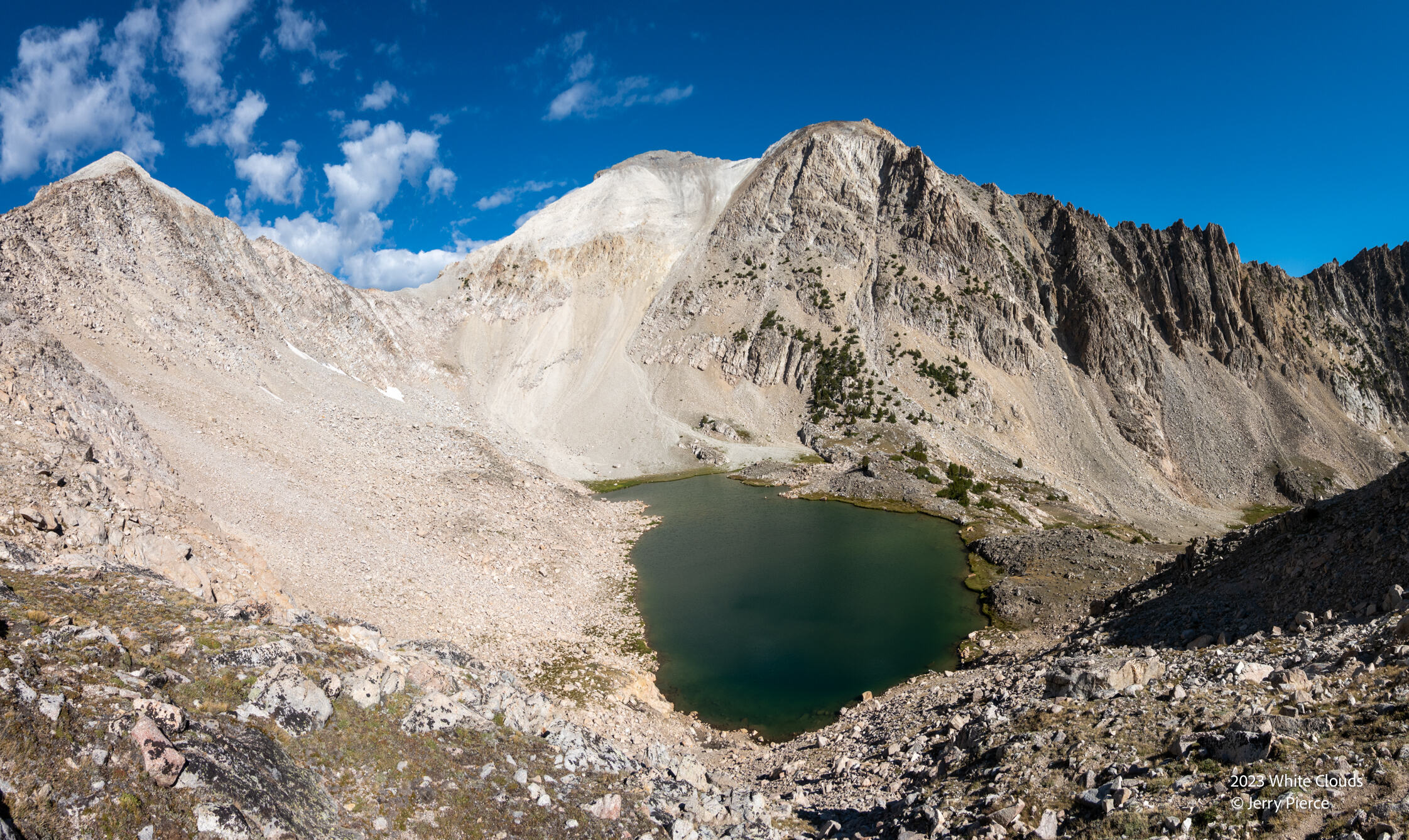
Slide lake from the pass
And looking the other side of the pass…
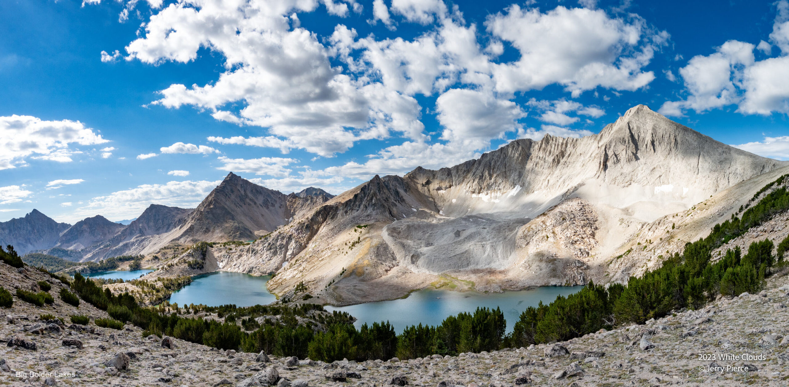
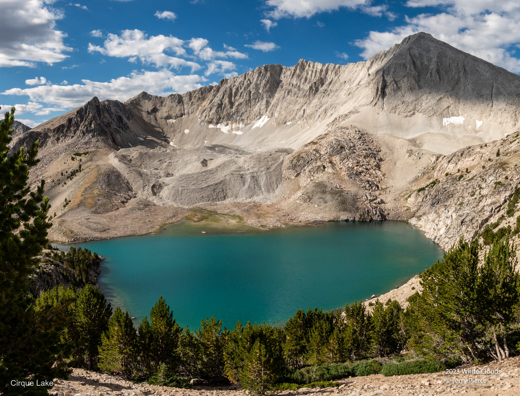
The view down Big Boulder Lakes – from Right to Left – Cirque Lake, Sapphire Lake, Cove Lake Lee Peak on the right
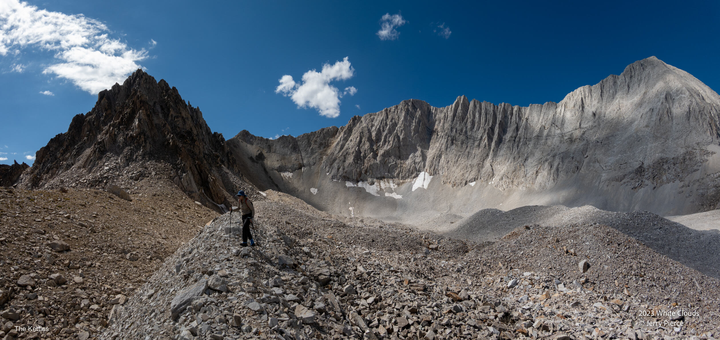
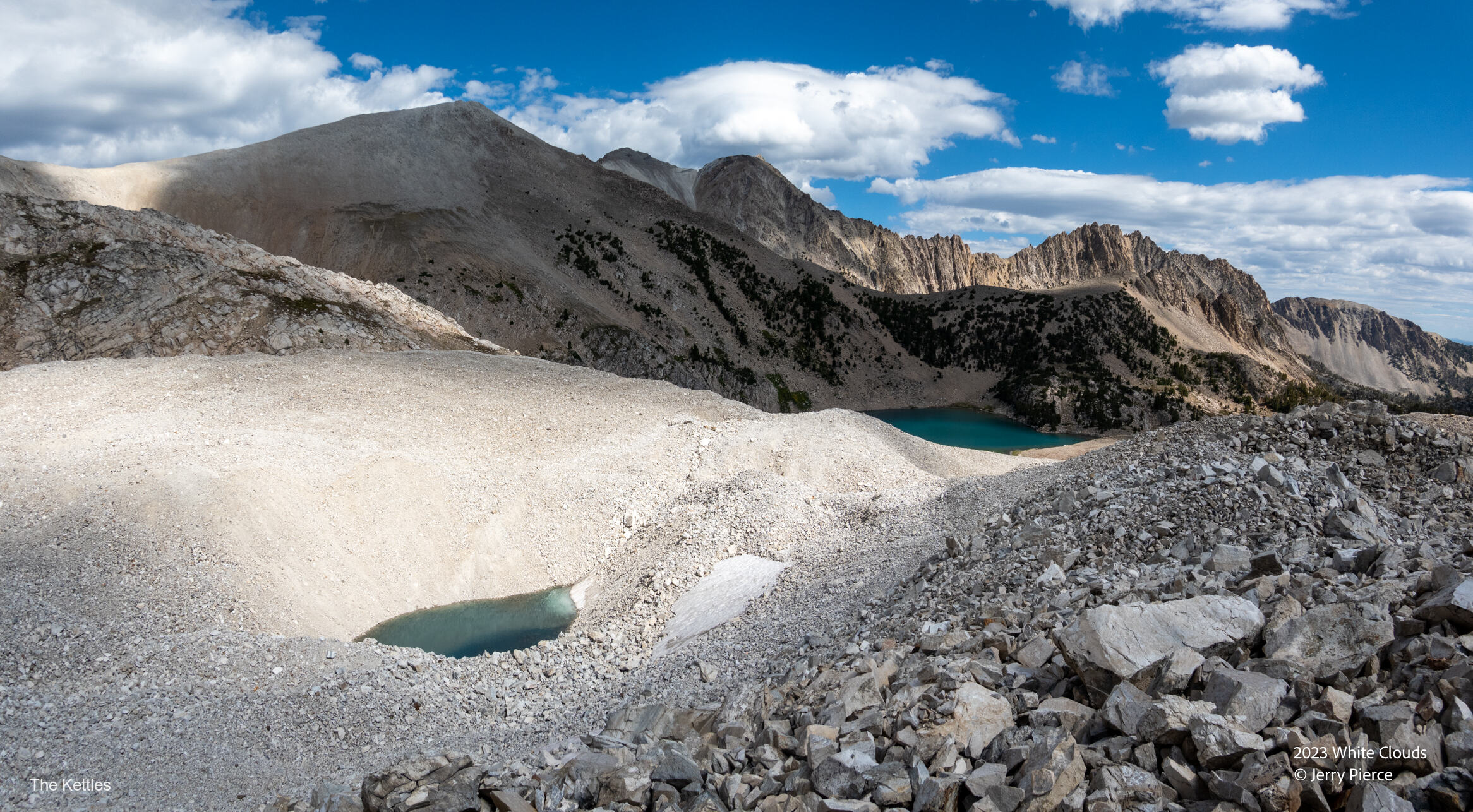
The section behind the middle of the highest lake was called “The Kettles.” It is a glacier covered by small nasty rocks. The map shows 3 small lakes there, but since it’s just a glacier we didn’t find those tarns, but a set of other ones – not very big and REALLY cold.
Another view of the top lake – Cirque Lake
The Kettles
One small tarn in the Kettles
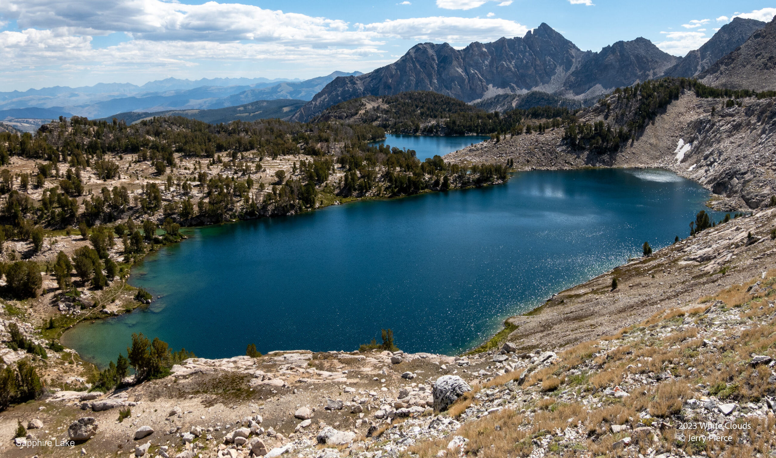
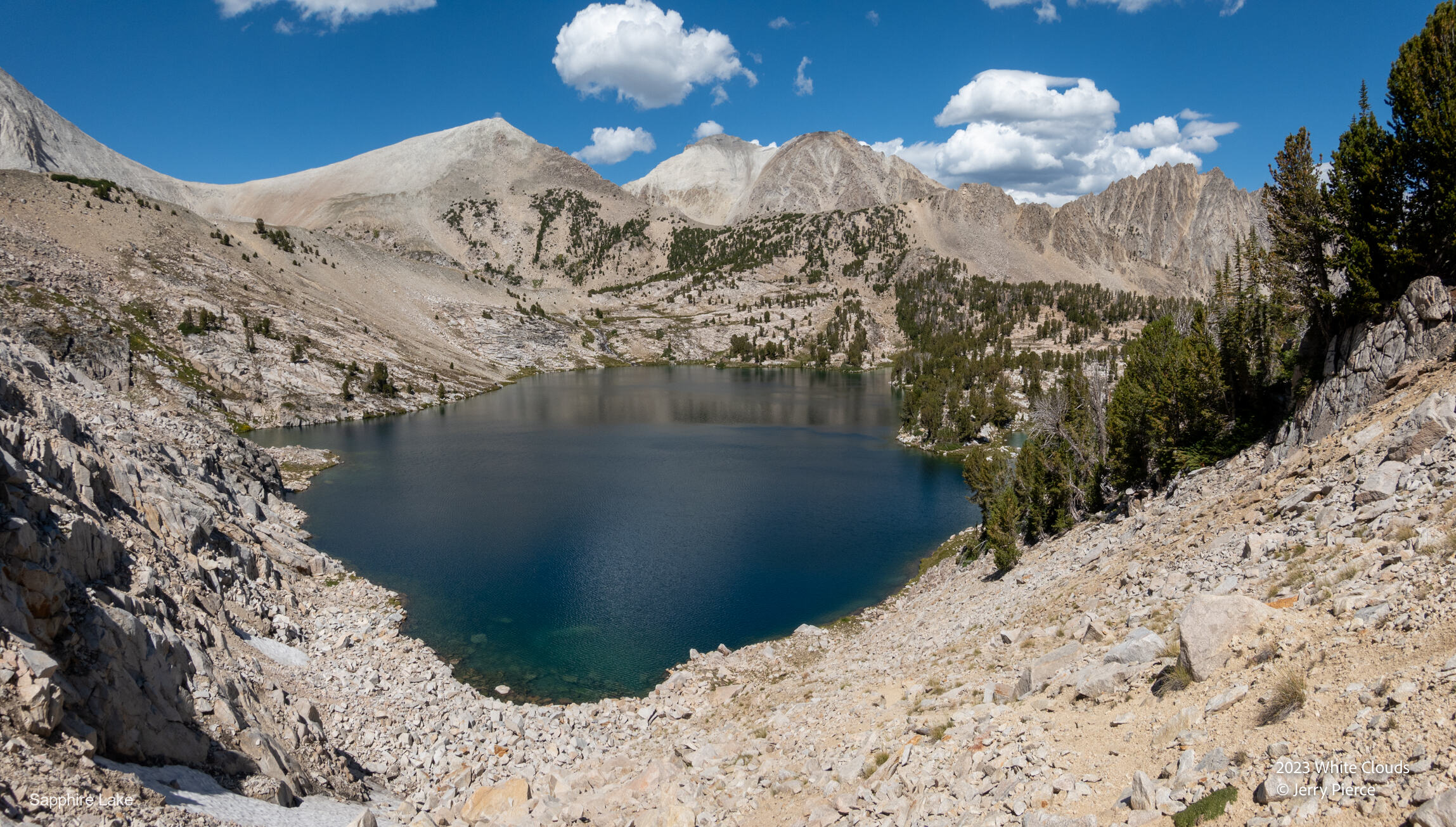
Off to Lunch next to Sapphire Lake
Sapphire Lake – Lunch was on the left shore – a great campsite!
Sapphire Lake from the other end.
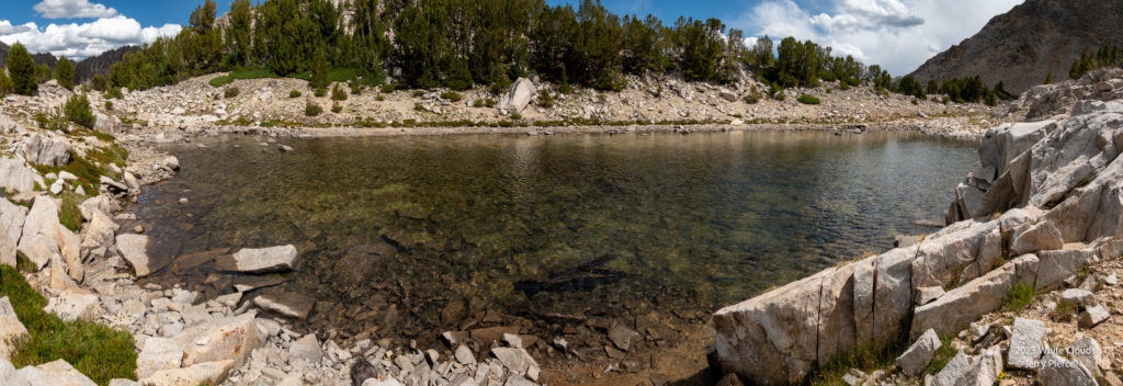
We wanted to go and see a few lakes up the hill and we found this shallow tarn near Boulder Lake. FINALLY a lake that was not freezing – still cold, but better. Enough for a rinsing dip in the middle of the day.
“Swimming” tarn – if only it was deeper
Cove Lake
Some great colors in the rock!
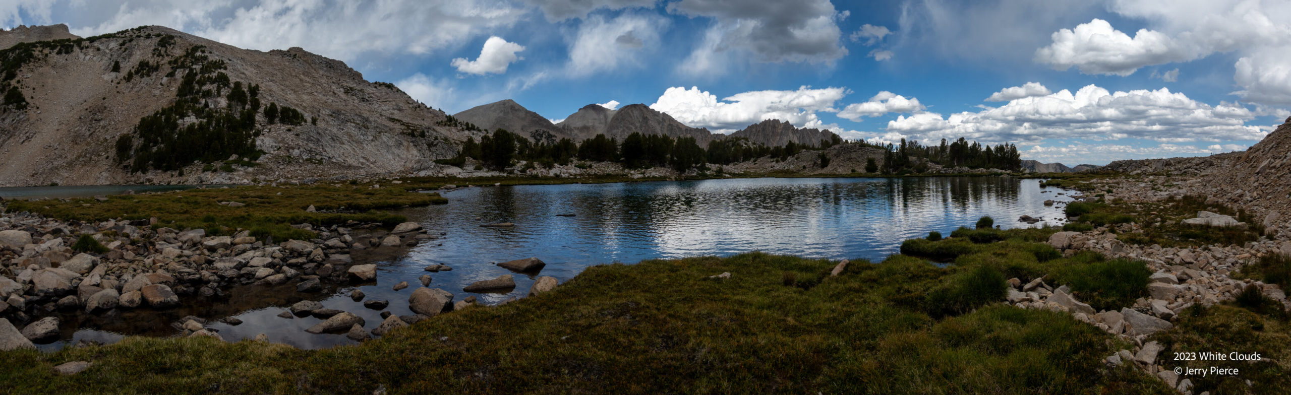
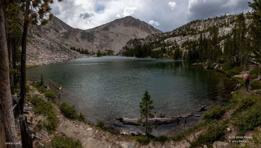
We did a loop near Boulder lake, Snow Lake and Gentian Lake and headed past Cove Lake to Island Lake
Island Lake – the dark clouds were real and we faced rain on the way back to Walker Lake!
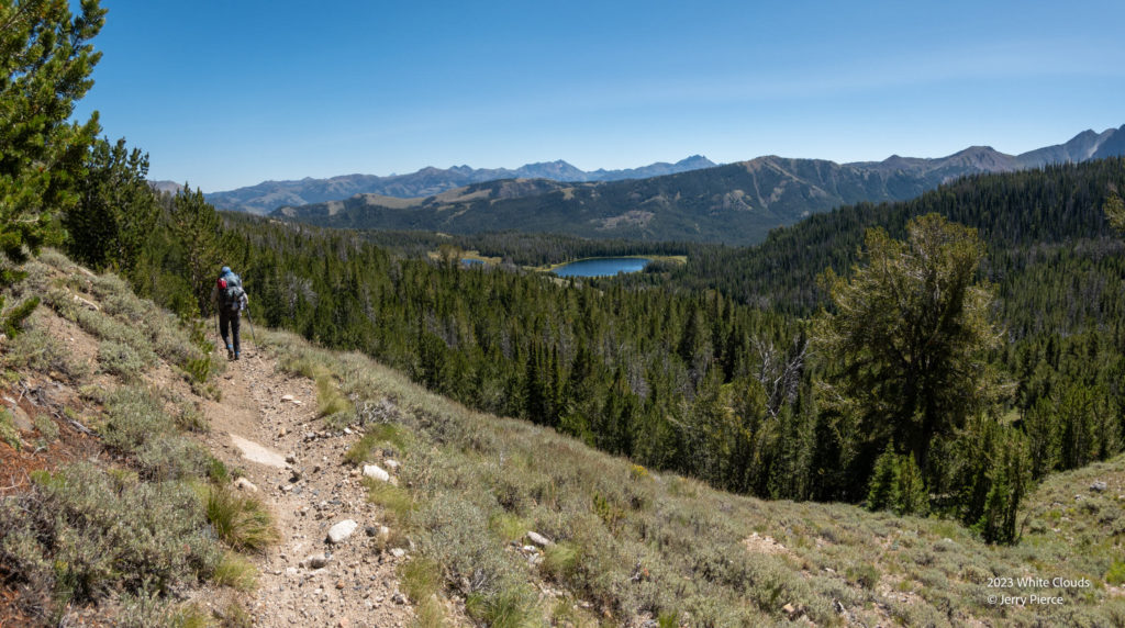
Day 5 and we retraced our track away from Big Boulder Lakes in the direction of Hatchet lake – ultimately aiming to Chamberlain Lakes. The day was clear (no great sunrise) and we just faced distance – 14 miles on trail!
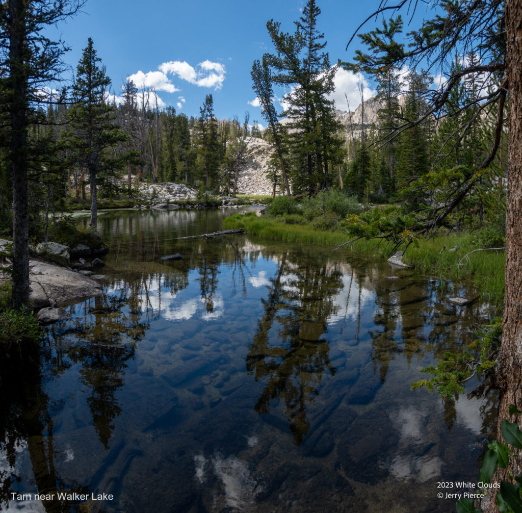
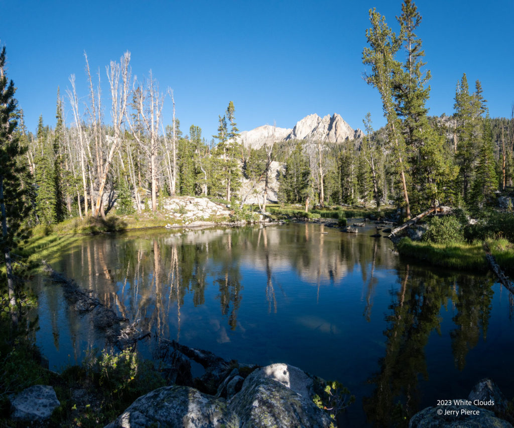
Another fun tarn close to Walker Lake
Frog Lake on the hike down. We encountered 5 motorcycles on this trail!
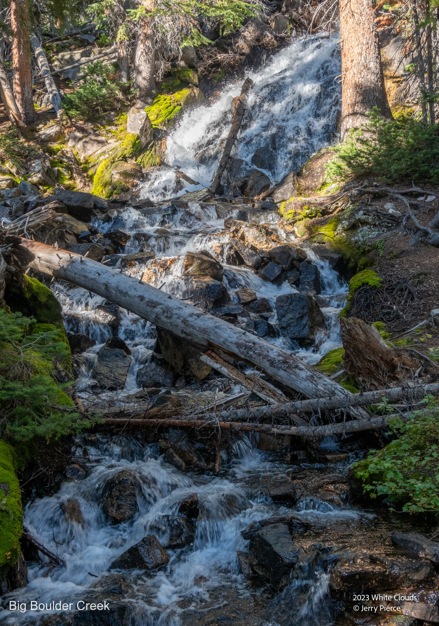
Not many waterfalls, but this was the pretty one!
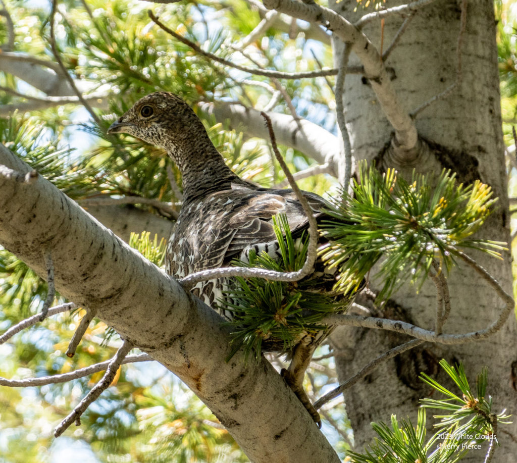
Dumb Bird
We wanted to get as far along as possible toward Chamberlain, so we moved past Willow Lake and headed up to the Little Boulder Creek crossing. Not the best campsite – right near the trail so we had two horses walk by in the evening and again early morning. It’s not like hiking in the Sierras!
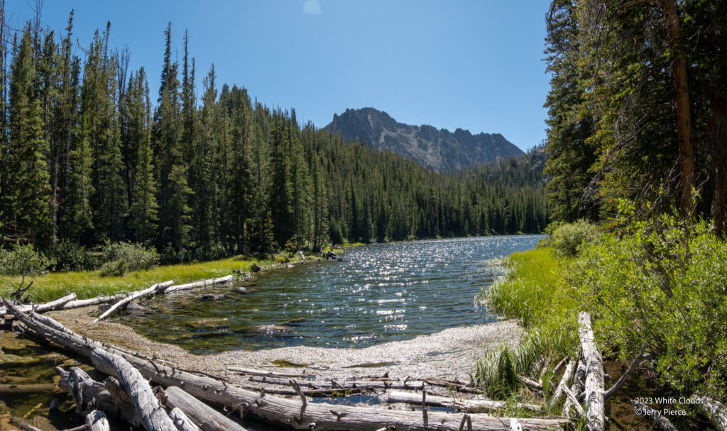
Willow Lake
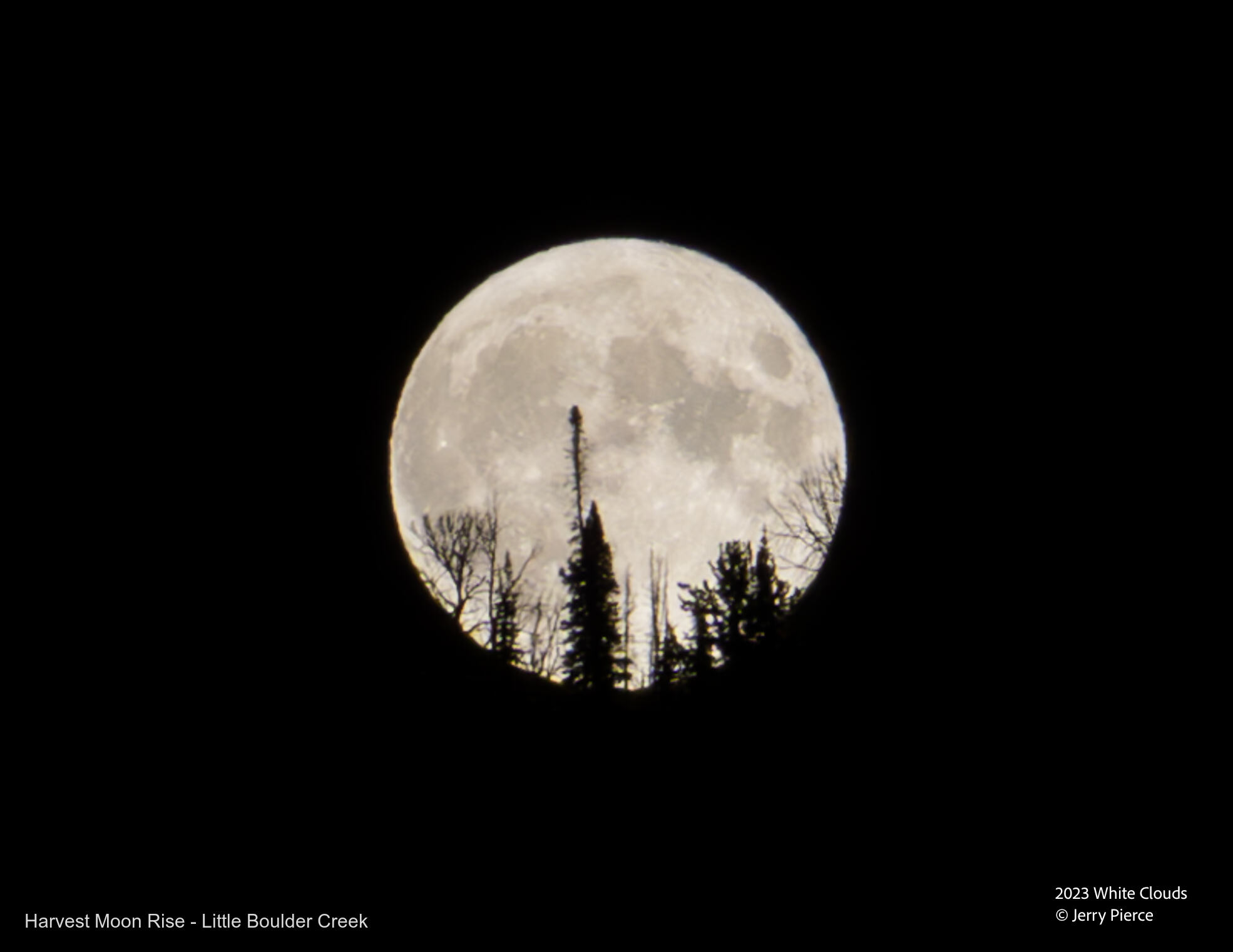
It was the night of the Super Moon so I stayed up to 9:51pm (late for hiking) and captured this view as the moon was rising over the hill.
The next morning we were off to Chamberlain lakes. We had considered hiking further the day before and go to Baker Lake, so we took the trail and checked out what we missed. There was another big group there – they had come in by horse, so we made a good choice to camp where we did. BUT it was a beautiful lake!
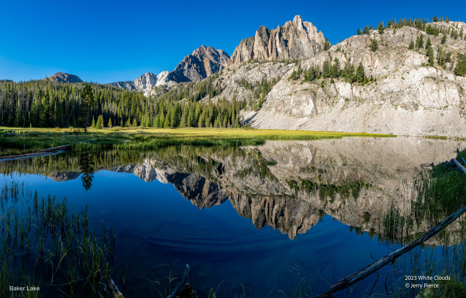
Baker Lake
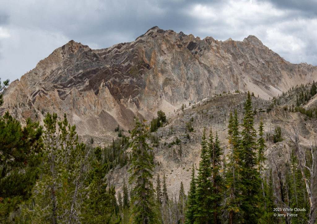
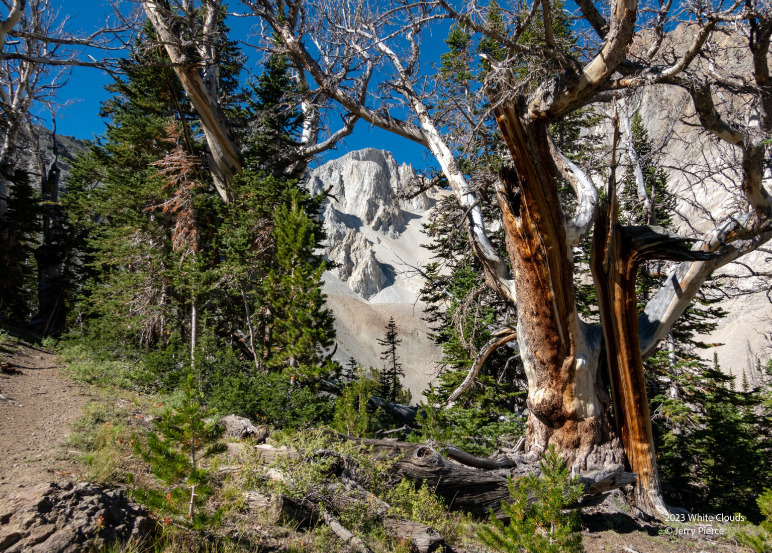
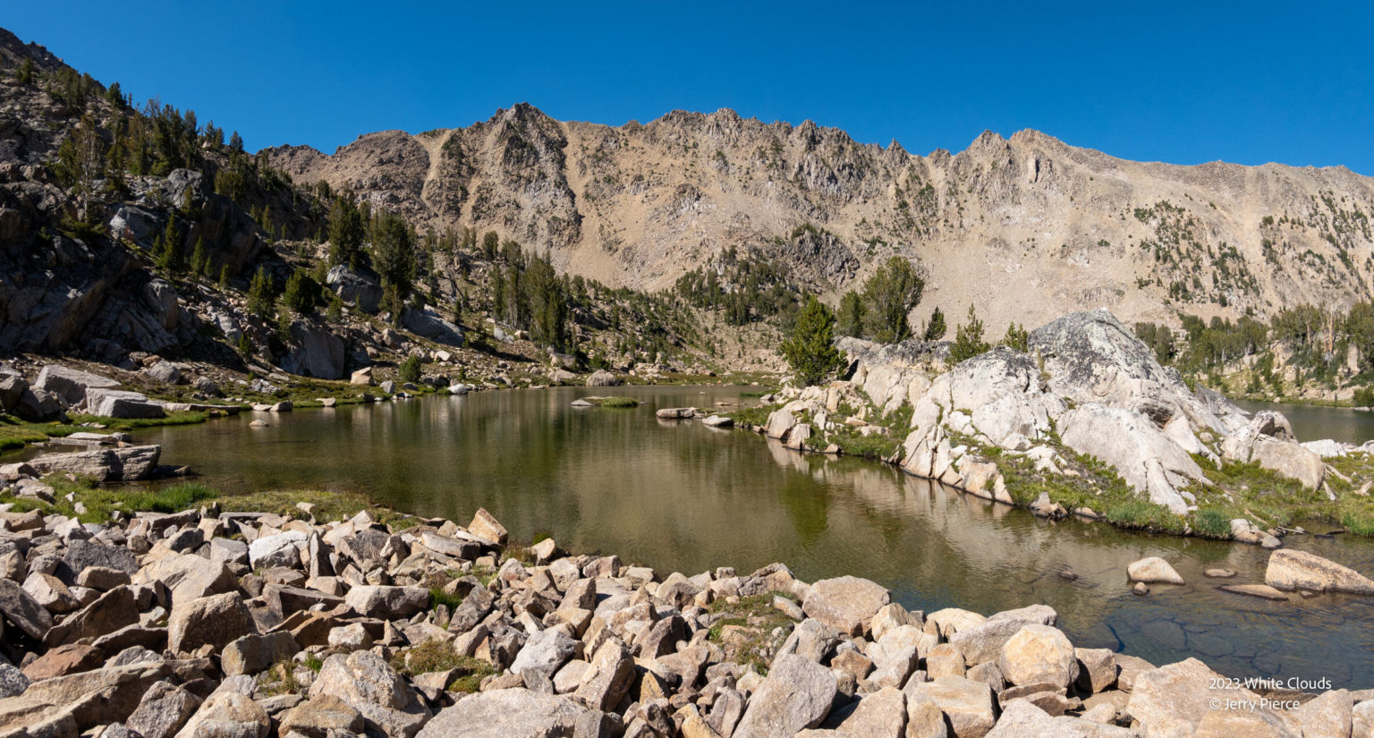
The White Clouds were really obvious on the hike up to Chamberlain
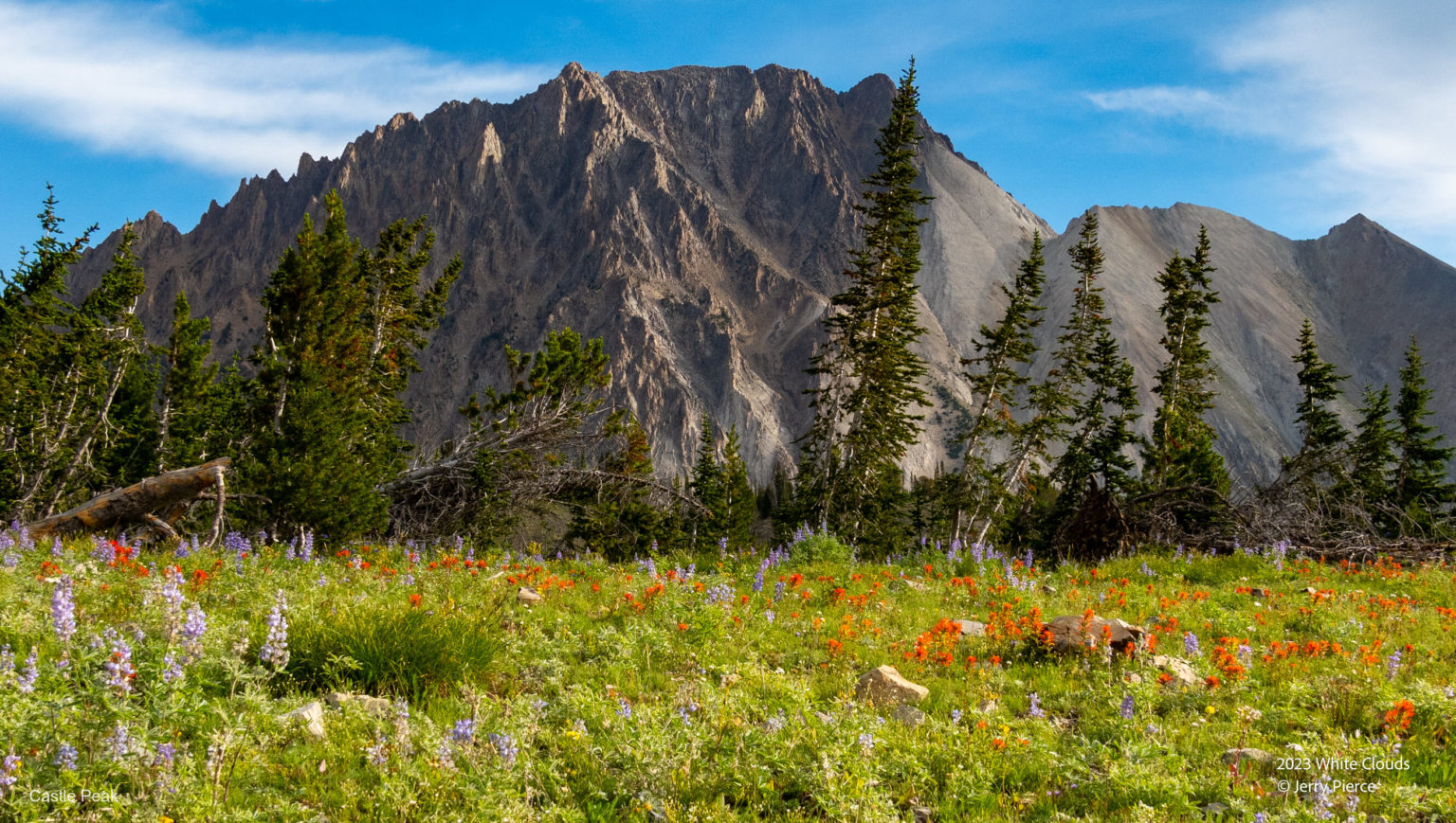
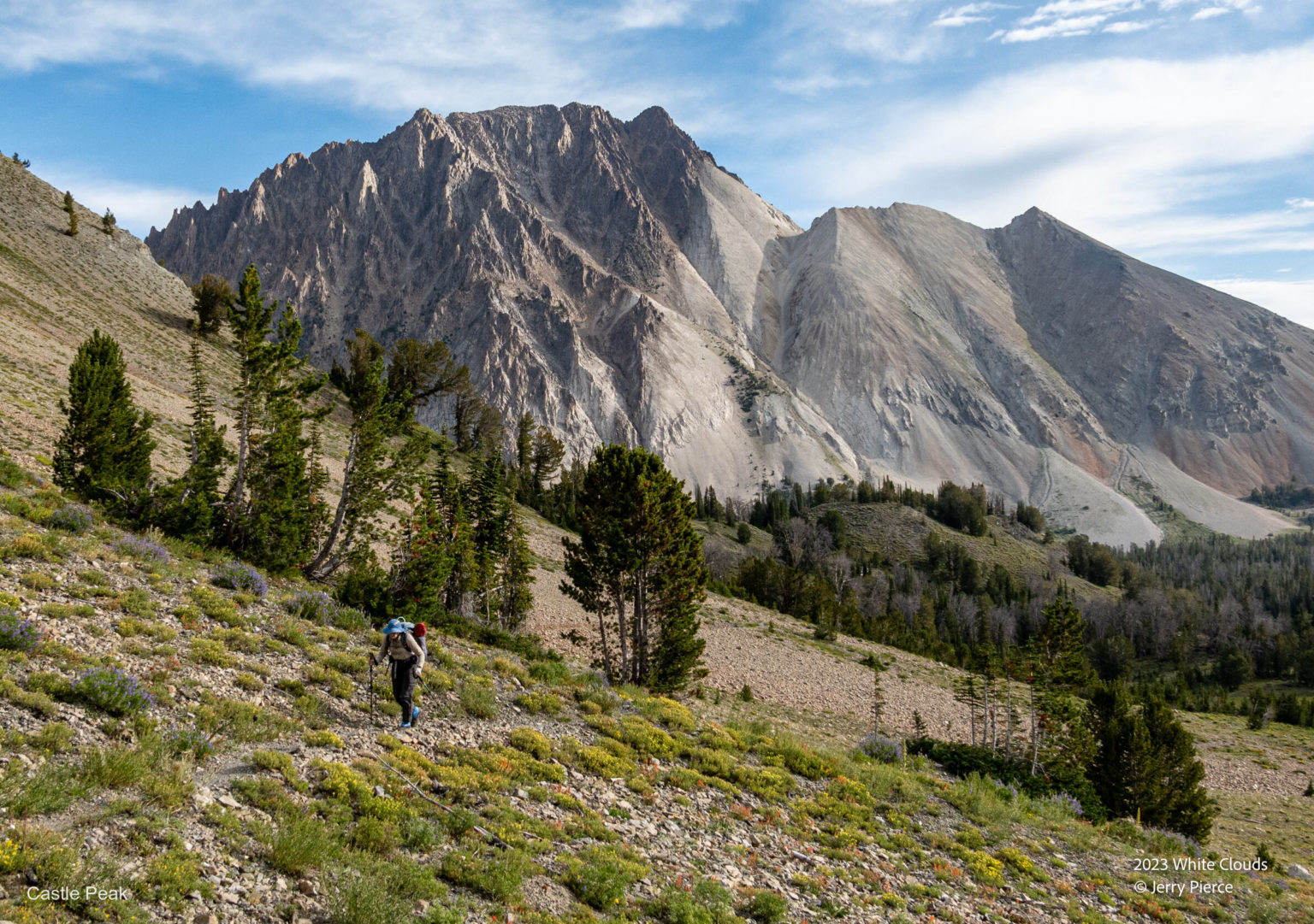
Castle Peak
White Clouds – duh!
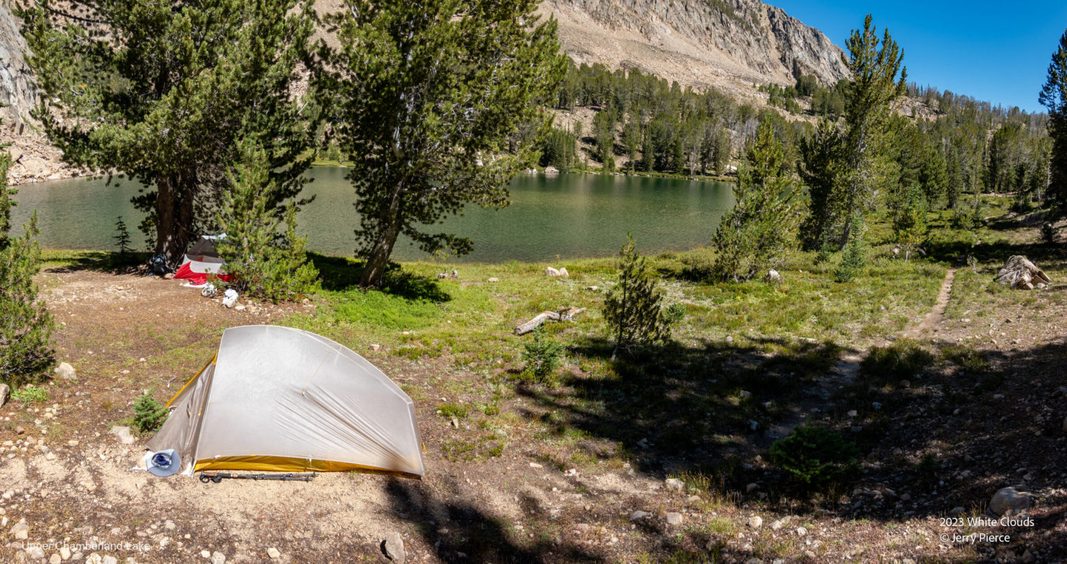
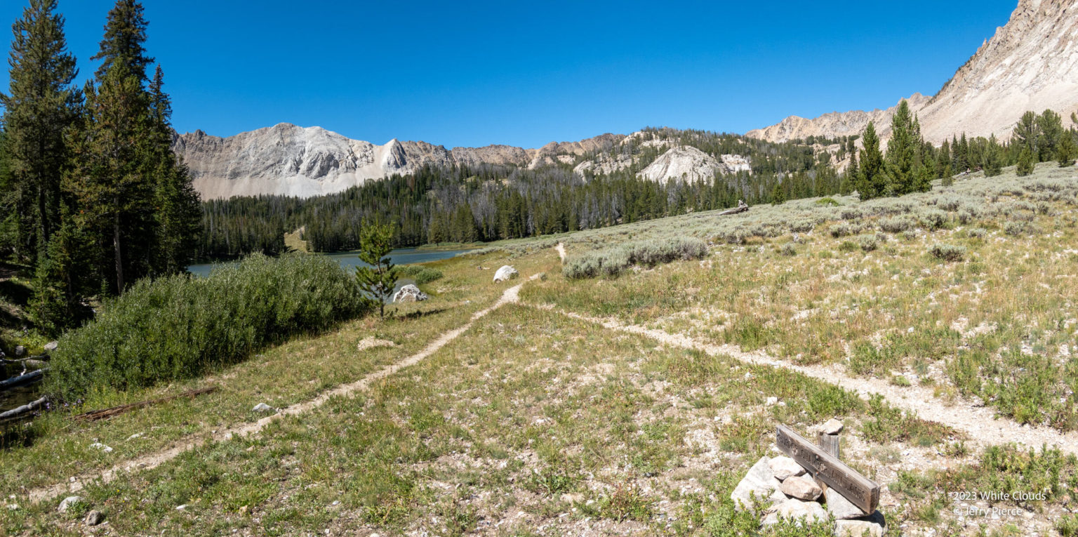
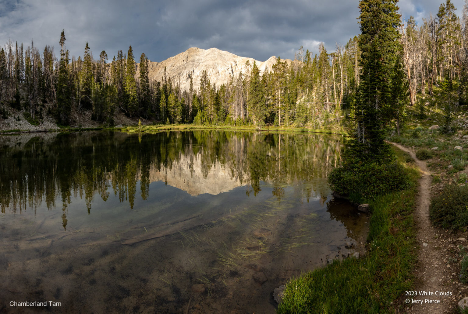
We arrived at the Chamberlain lakes and found a delightful place to camp where we could still have a fire!
The lowest Chamberlain Lake
Our home – the campsite was at the far end
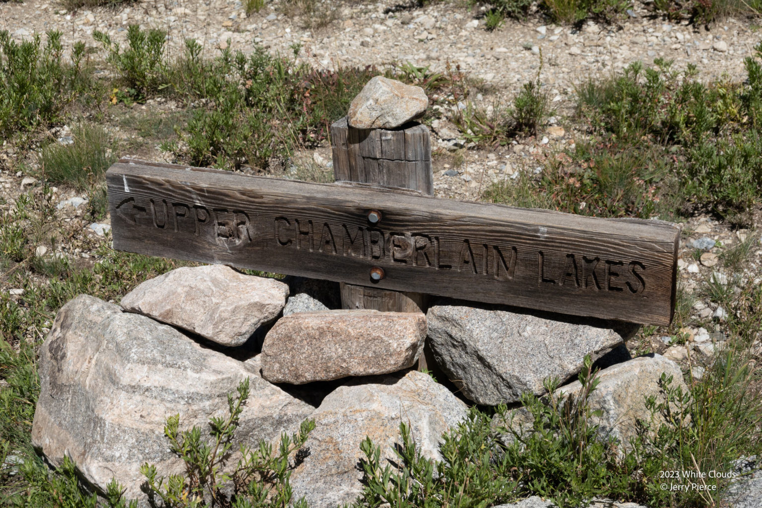
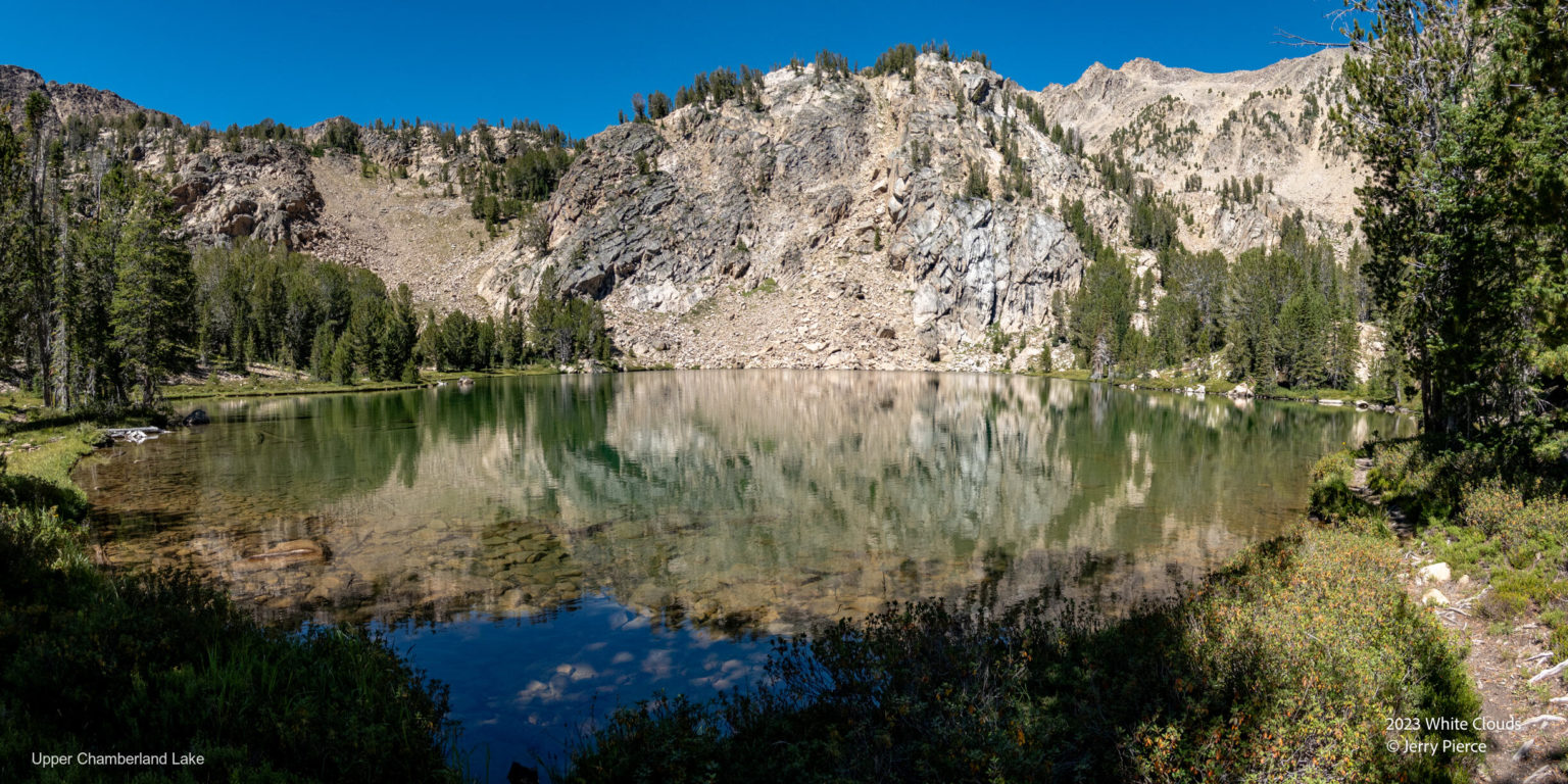
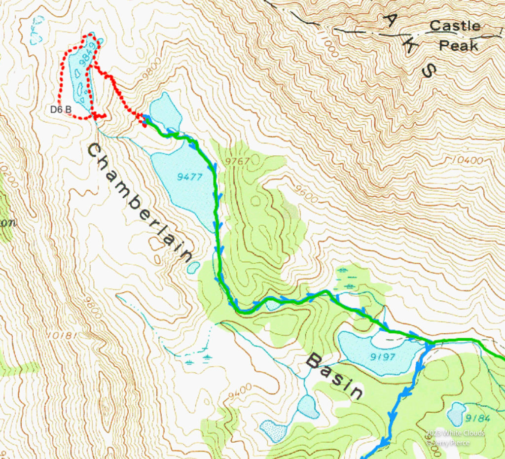
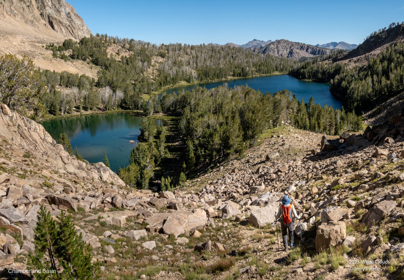
After setting up our camp, we took a short day hike to the uppermost Chamberlain Lake – named 9849. Classy name.
Lake 9849
Looking down at our lake and the next one down from the approach to 9849
And our last day hiking – Day 7 – we leave as it’s just a bit overcast and head to the trailhead.
The wildflowers were wonderful!
Castle Peak
And back to our car. No problem. Drive back to Boise.
According to my Garmin Watch it was 69.7 miles with 16K ascent. (Garmin tends to show longer than other devices).
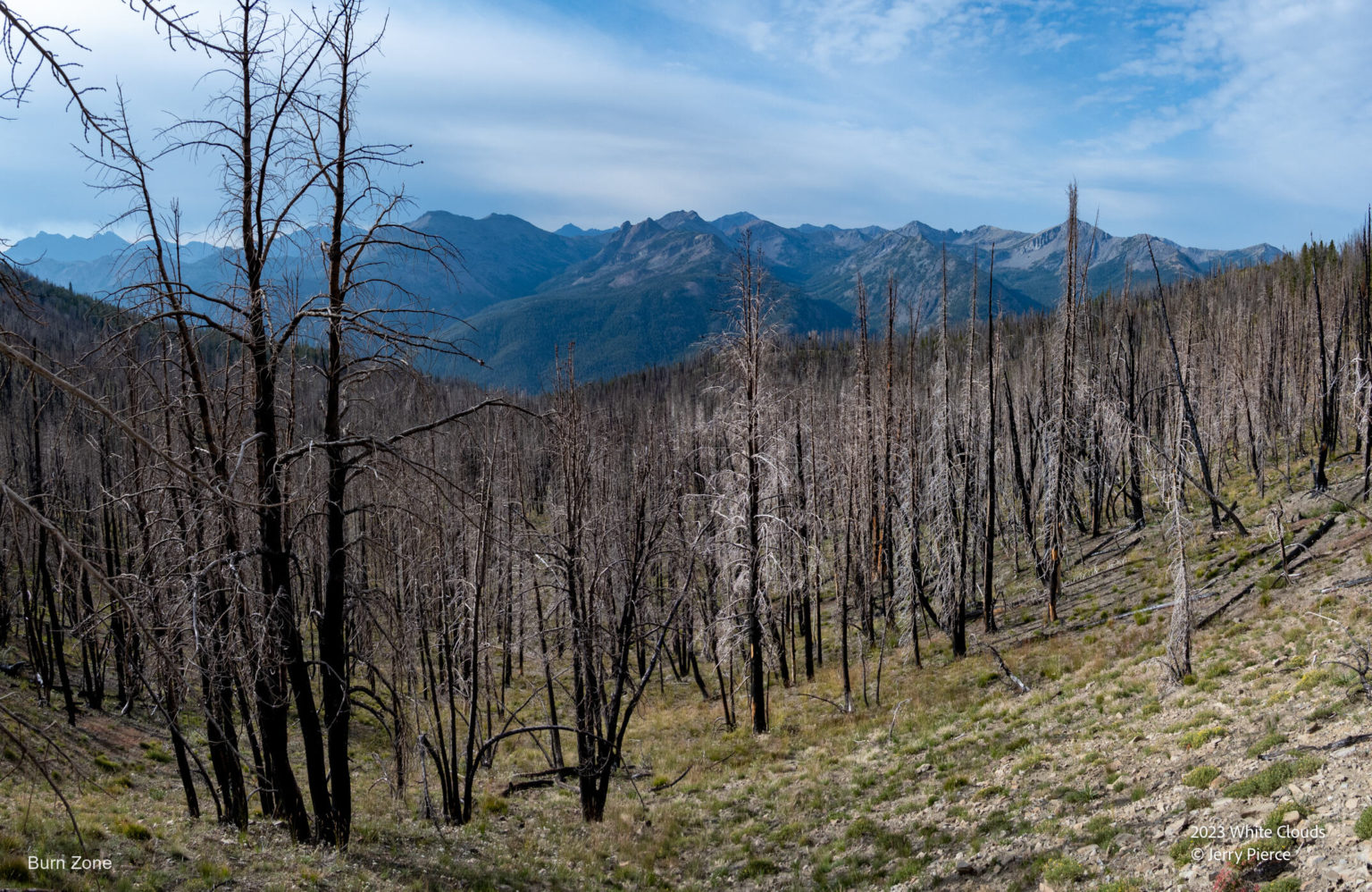
On the way out we pass through a section that had burned in 2018